
For roughly 800 years, the Reykjanes Peninsula, just 40 kilometres from Reykjavík, did not erupt. Then, in March 2021, a crack opened in a remote valley called Geldingadalir and began oozing lava so calmly that people hiked in to watch it, and then kept coming for months. That much is the story the headline promises: a volcano that, for a while, behaved so politely it built a whole new landscape without wrecking anyone’s travel plans.
Two corrections keep that story honest. “Quietly” is accurate for the Fagradalsfjall eruptions of 2021 to 2023, not for what followed on the same peninsula since December 2023. And “natural wonder” is an editorial label, not an official designation: Iceland’s own tourism board calls the area “the newest landscape of Iceland.” It is a young, still-cooling lava field, and the way it came to be is the real wonder.
How this guide was built: the eruption dates, volumes and visitor figures come from Wikipedia’s compiled Fagradalsfjall record cross-checked against the Icelandic Meteorological Office, the Smithsonian Global Volcanism Program, Visit Reykjanes and expert commentary reported by Euronews. Where sources disagree or measure different things, the text says so. Last verified: October 2026.
Fagradalsfjall at a glance
- Location: Reykjanes Peninsula, southwest Iceland, roughly 40 km from Reykjavík and close to Grindavík
- The three eruptions: Geldingadalir (March 19 to September 18, 2021), Meradalir (August 3 to 21, 2022) and Litli-Hrútur (July 10 to August 5, 2023)
- Character: effusive, meaning lava flowed out rather than exploding as ash
- Name: from the Icelandic fagur (beautiful), dalur (valley) and fjall (mountain)
- Status as of the latest Icelandic Met Office update (September 30, 2026): no eruption in progress; the most recent one on the peninsula began July 16, 2025
- Best for: hikers who want to walk across a landscape younger than most of their own lives, with current conditions checked before leaving
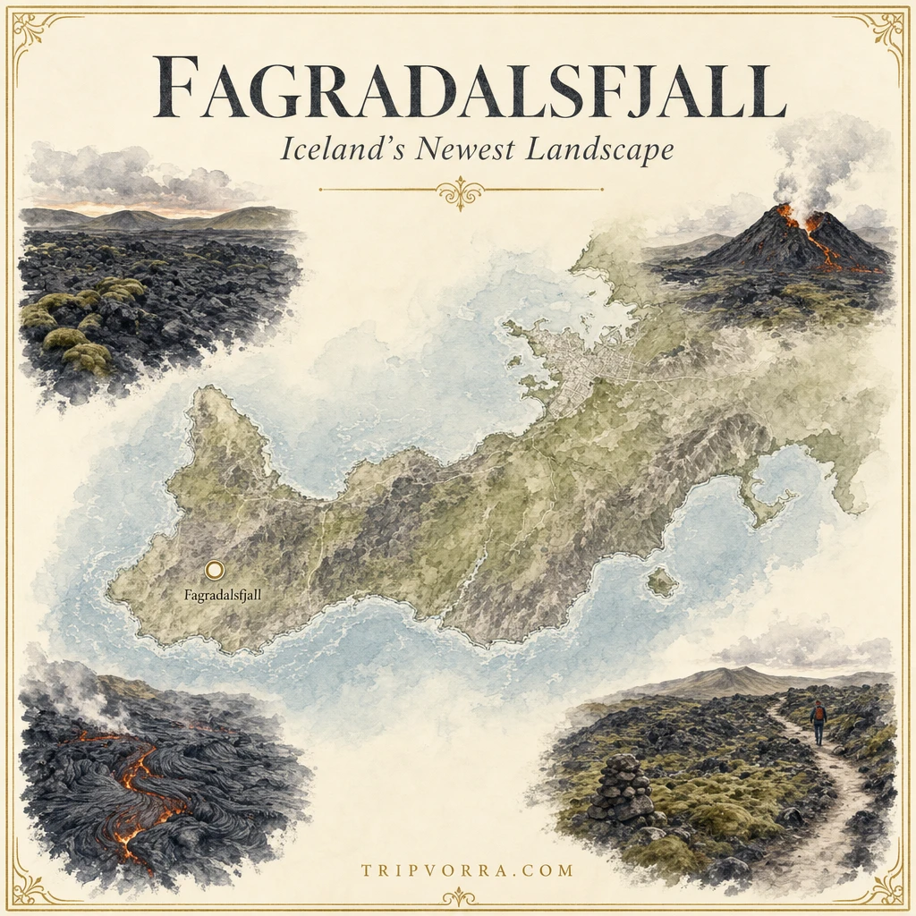
A peninsula that had been silent for centuries
The Reykjanes Peninsula is where Iceland’s mid-Atlantic rift comes ashore, so volcanic activity is not unnatural here. It is just rare on human timescales. The Smithsonian’s Global Volcanism Program notes that eruptions on the peninsula in historical times occurred in the 13th century, and news coverage in March 2021 described the first eruption there in nearly 800 years. Wikipedia’s count puts the gap at 815 years; since the exact gap depends on which medieval eruption you count as the last, “roughly 800 years” is the safe way to say it.
What makes 2021 feel like a surprise rather than an inevitability is that the warning was long and loud. The area had been shaken by swarms of earthquakes and magma intrusions beginning in 2020, and when the ground finally split in Geldingadalir, scientists were ready to watch it.
Why “quiet” fits, and where it stops
The 2021 eruption was effusive: lava poured out of vents and flowed, with no explosive ash column of the kind that grounded European flights after Eyjafjallajökull in 2010. University of Iceland geophysicist Magnús Tumi Gudmundsson, quoted by Euronews, described the eruptions as “only mildly explosive,” with flows occurring “only at the vents,” and not especially dangerous “if you approach them with respect and keep a safe distance.”
“Quiet” never meant harmless. The same expert coverage points to sulphur dioxide as the real hazard, along with weather and getting lost. The 2014 to 2015 Holuhraun eruption in the highlands had to be closed to visitors because of dangerous gas. Gentle lava is not the same as a safe site.
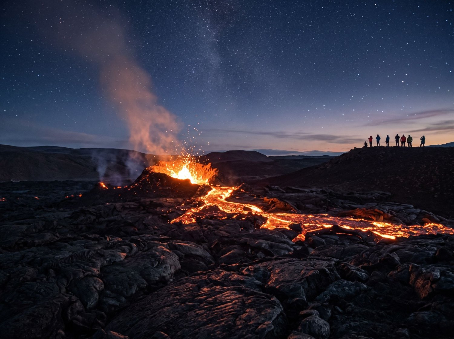
Three eruptions, one new landscape
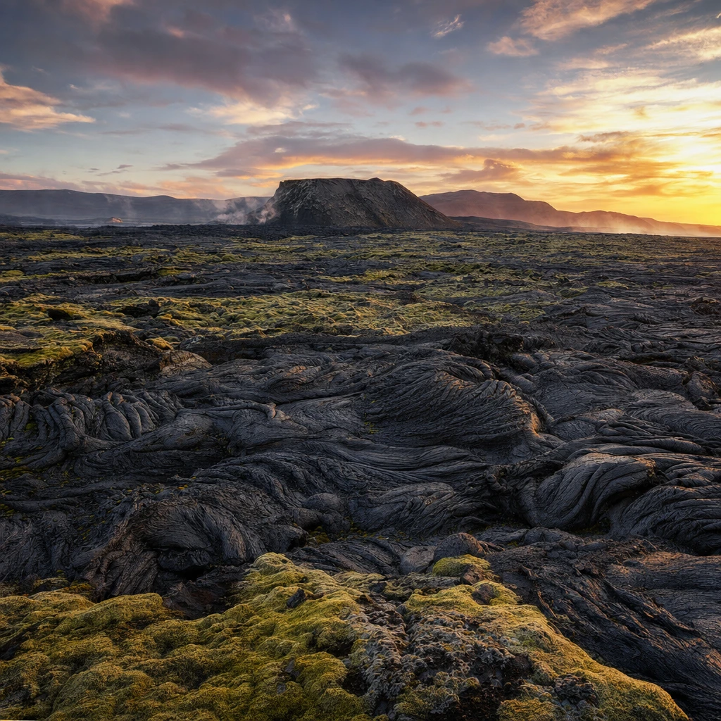
The first eruption, in Geldingadalir, ran from March 19 to September 18, 2021. At 181 days, it became the longest Icelandic eruption of the 21st century to that point, covering about 4.8 square kilometres with roughly 151 million cubic metres of lava, according to Wikipedia’s compilation of the monitoring data.
The next two were short by comparison. Meradalir erupted for 19 days in August 2022, adding about 12 million cubic metres. Litli-Hrútur, which produced the freshest cone in the area, ran from July 10 to August 5, 2023, with about 15.9 million cubic metres across 1.5 square kilometres. Together they left a patchwork of black lava fields, craters and new valley floors that did not exist five years ago.
The volcano you could walk to
What turned a geological event into a travel story was access. Fagradalsfjall sits close to Reykjavík and the international airport, and Icelandic authorities took an unusually open approach: Wikipedia’s summary of their stance is that they tried to inform people rather than ban them. The Icelandic Tourist Board counted more than 356,000 visitors at the site, as reported by Euronews, and pedestrian counters installed by the Icelandic Environment Agency recorded peaks of up to 12,000 visits a day, settling to around 2,500 a day. Other sources cite higher cumulative totals (Wikipedia mentions about 700,000 since 2021), which likely reflect different time windows and counting methods, so treat any single total as an estimate.
One telling detail from the counters: the site drew more visitors after dark, when the glowing lava was at its most dramatic.
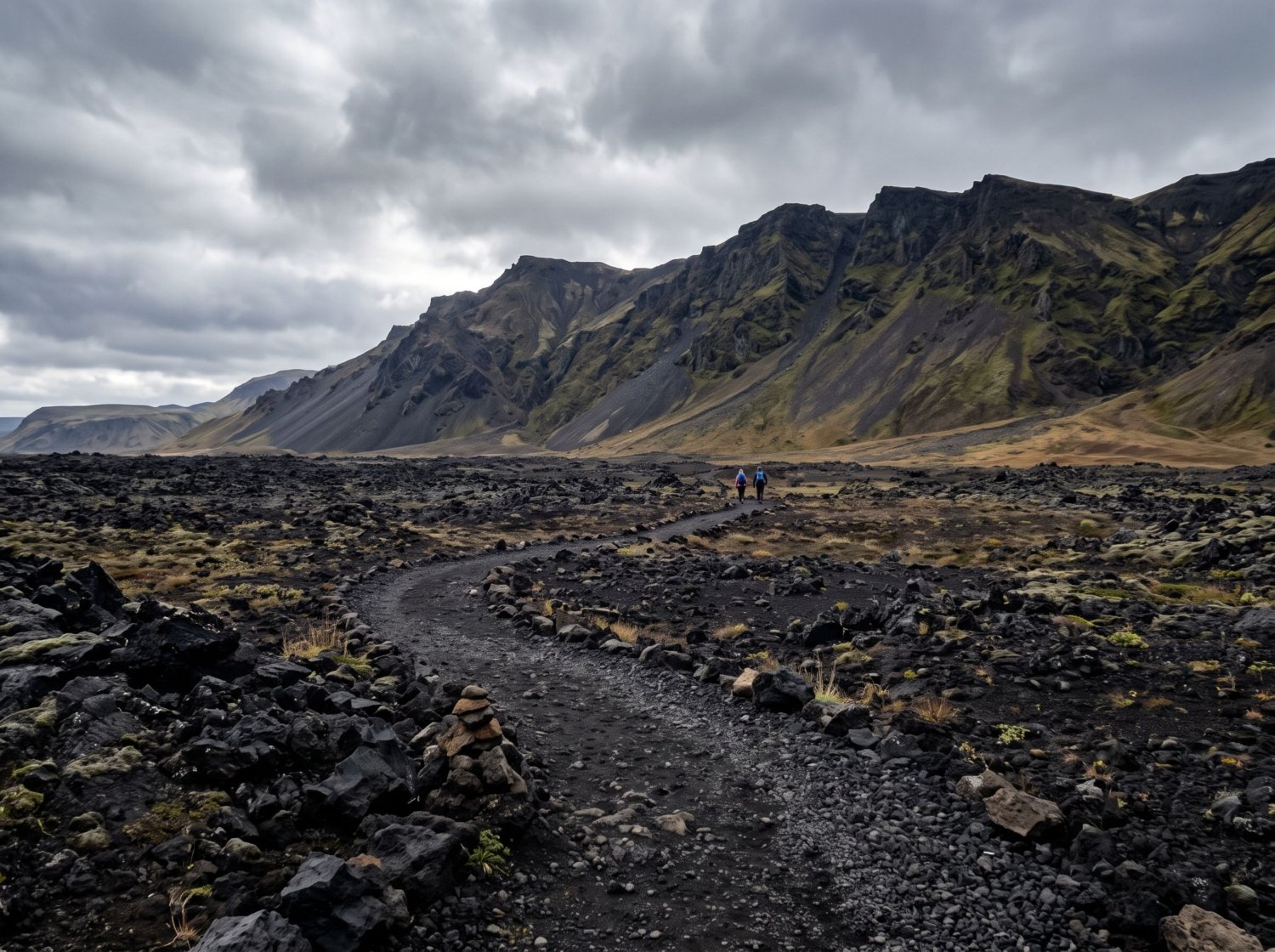
When the same peninsula stopped being quiet
This is the part a “quiet volcano” headline cannot carry. In November 2023 the nearby town of Grindavík was evacuated, and from December 18, 2023 a different set of fissures, the Sundhnúkur crater row, began a series of eruptions. According to the timeline compiled on Wikipedia, there were nine between December 2023 and August 2025. The January 2024 eruption reached the edge of Grindavík and destroyed three homes, the February 2024 eruption damaged the hot-water pipeline serving the Svartsengi power station, and the November 2024 eruption engulfed the Blue Lagoon’s car park.
Volcanologists describe this as a different phase, not a continuation of the gentle Fagradalsfjall chapter: it directly threatened infrastructure and homes, and it is expected to continue on and off for decades or longer. If Fagradalsfjall was the peninsula’s polite reawakening, Sundhnúkur is the part where it asserted itself.
Where things stand now
The Icelandic Meteorological Office’s update of September 30, 2026 states that the last eruption began on July 16, 2025, and that about four centimetres of ground uplift has been measured over the past three months, indicating pressure is still building beneath Svartsengi. The most likely scenario, it says, is another magma intrusion toward the Sundhnúkur crater row that could lead to an eruption. Grindavík remains in the considerable (orange) hazard category, and the warning time before earlier events ranged from about 20 minutes to just over four hours.
In other words, no eruption is under way right now, but the system is visibly recharging, and any visit should be planned around live conditions rather than a guidebook.
The honest downsides
This is not a hidden spot. It is one of the best-known hikes in Iceland, and it comes with real caveats. Fresh lava can look solid while remaining dangerously hot beneath a thin crust, according to Visit Reykjanes, and volcanic gas levels can change with the wind. Access can also change at short notice if activity resumes, so a trail that is open today may not be next week.
The landscape itself is also stark rather than pretty in the postcard sense: black rock, gravel, wind and very little shelter. It rewards people who want to see geology in action, and can underwhelm people expecting a green Iceland waterfall day.
Visiting Fagradalsfjall today
- Check conditions first: Visit Reykjanes directs hikers to vedur.is for gas forecasts and safetravel.is for current conditions, and warns that access may change at short notice.
- Pick a route: the official trail list includes Path B (about 4.7 km one way to the first viewing site), Path A (6 to 8 km one way, roughly 2 to 2.5 hours) and Path E to the Meradalir and Litli-Hrútur area (an 18 to 20 km round trip, 5 to 6 hours).
- Parking: at the time Visit Reykjanes last updated its page (December 2024), the P1 and P2 car parks each charged 1,000 ISK for 24 hours via parka.is; confirm current fees and trail status before you go.
- Dress for the hike, not the drive: exposed terrain, gravel, lava fields and steep hills mean sturdy boots, layers and plenty of water.
FAQ
Is Fagradalsfjall erupting right now?
As of the Icelandic Met Office’s September 30, 2026 update, no. The last eruption on the Reykjanes Peninsula began on July 16, 2025, though the agency says magma continues to accumulate and a new intrusion is the most likely scenario. This can change quickly, so check vedur.is before travelling.
Is it officially Iceland’s newest natural wonder?
There is no official “natural wonder” designation. Visit Iceland calls the area the newest landscape of Iceland, which is the accurate way to put it.
Why was the 2021 eruption so calm?
It was effusive: lava flowed out of the vents rather than erupting explosively into an ash cloud. Experts quoted by Euronews describe the eruptions as only mildly explosive, with flows confined to the vents.
How long is the hike?
It depends on the route: roughly 4.7 km one way on Path B and 6 to 8 km one way on Path A, while the Meradalir and Litli-Hrútur route is an 18 to 20 km round trip. Allow several hours.
If you enjoy the science behind a landscape, the chemistry behind Havasu Falls’ impossible blue-green water makes a good companion read, and our Faroe Islands itinerary guide covers the same lesson about planning around weather rather than a fixed schedule.