
Most of New Mexico’s famous rock country comes with a parking lot, a paved overlook, and a permit lottery. The Bisti/De-Na-Zin Wilderness has none of that. There’s no marked trail, no ranger station, no cell signal, and no fee — just 45,000 acres of eroded badlands south of Farmington where wind and water have spent millions of years carving hoodoos, cracked-clay hills, and fossilized logs out of rock laid down before the dinosaurs disappeared. It’s not hidden because nobody’s heard of it; photographers and geology students have known about it for decades. It’s hidden because almost nothing about visiting it is convenient, and that has kept it quiet in a way permits and crowd caps never could.
Last verified: September 10, 2026. This guide was built from Bureau of Land Management visitor pages, Wikipedia’s geological summary of the wilderness, and independent hiking/photography guides to the area — not a personal visit — and every factual claim below is linked to its source in the sentence that makes it.
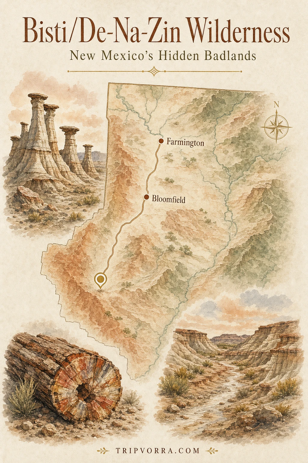
| Location | San Juan County, New Mexico, about 36 miles south of Farmington |
| Size | 45,000 acres of designated Wilderness |
| Established | 1984, expanded by roughly 2,250 acres in 2019 |
| Fee / permit | None |
| Trails | None marked — informal routes only, off-trail travel expected |
| Best season | Spring and fall |
What This Place Actually Is
The badlands themselves are geologically young — the erosion that carved today’s hoodoos and clay hills happened within roughly the last 2.8 to 5.6 million years, a blink relative to the rock itself. That rock is older and far more consequential: the wilderness exposes four stacked geologic formations — the Fruitland, Kirtland, Ojo Alamo, and Nacimiento — that together preserve one of the longest, most complete, and most fossil-rich rock sequences spanning the Cretaceous-Paleogene boundary found anywhere, the same boundary marked globally by the asteroid impact that ended the age of dinosaurs. Around 200 plant and animal species have been identified in these layers, including dinosaurs like Parasaurolophus, Pentaceratops, and Tyrannosaurus, petrified logs and leaf impressions, and some of the earliest Paleocene mammals that appear in the fossil record right after that extinction.
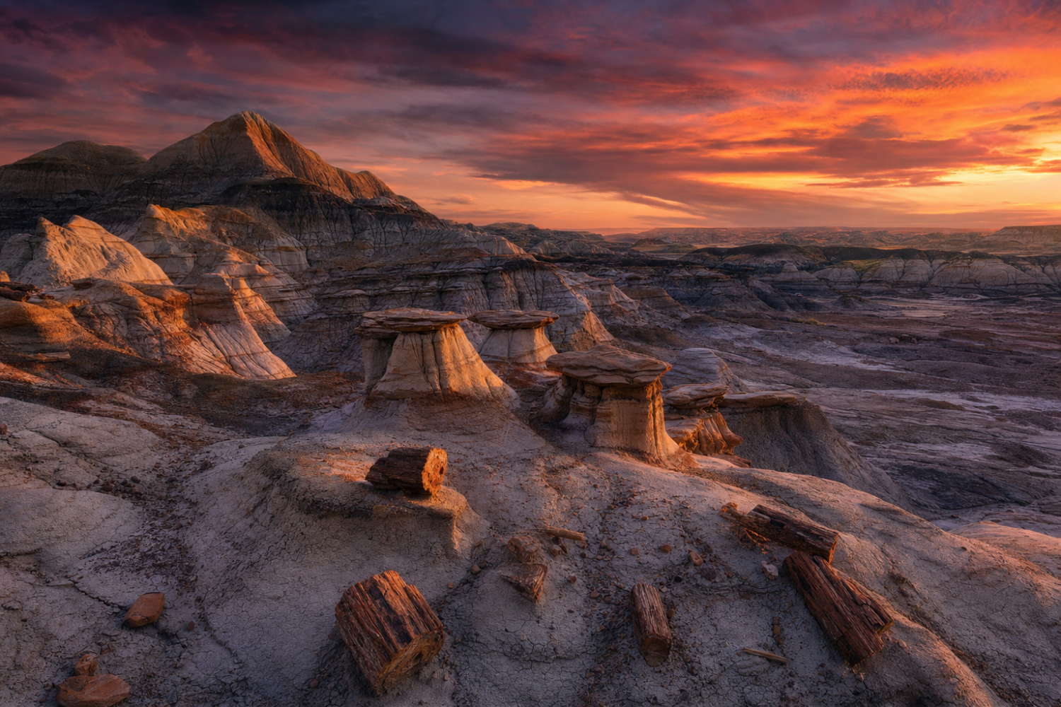
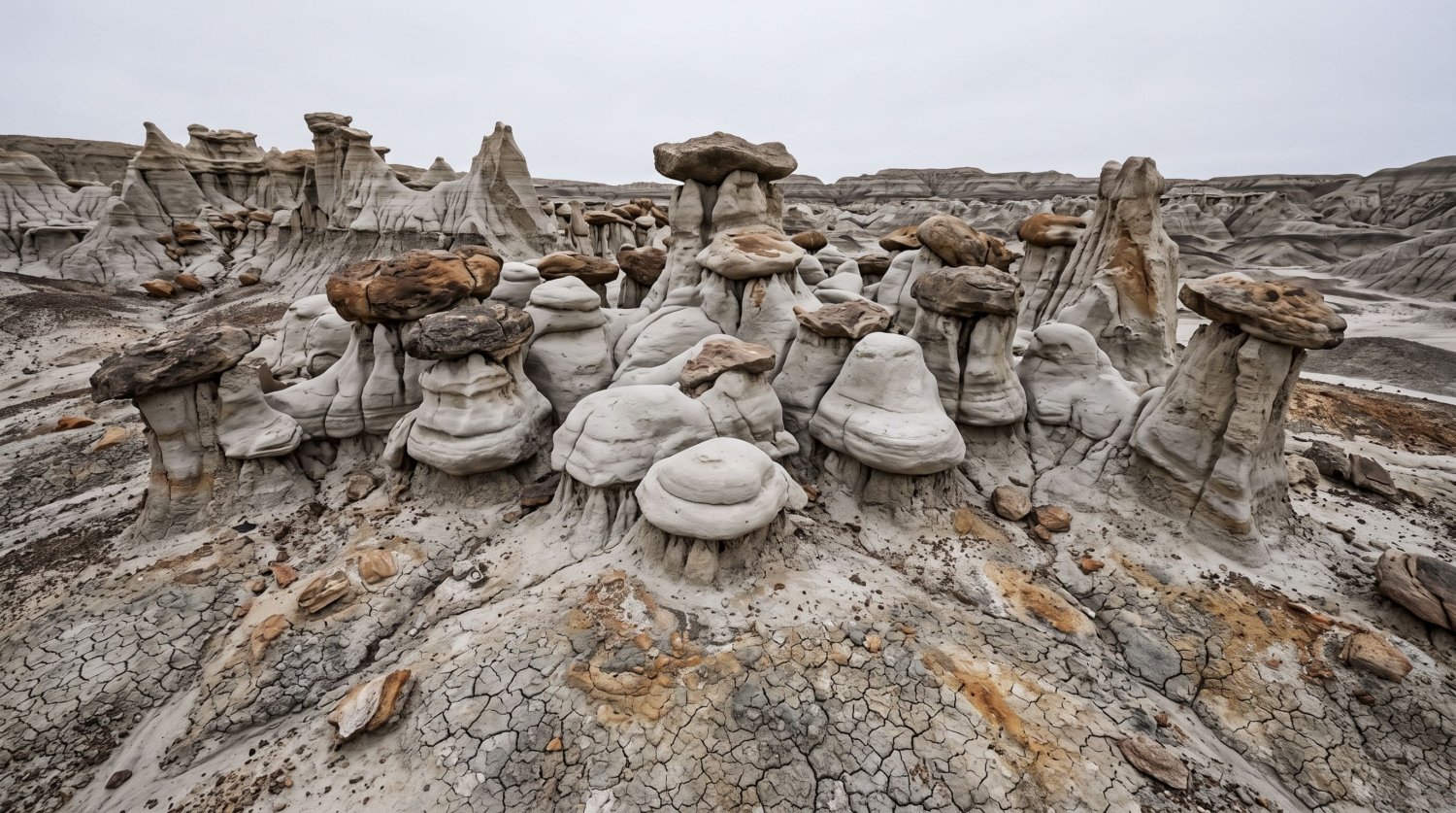
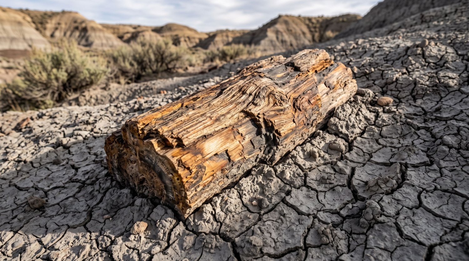
None of that history is roped off or explained on a placard, because there isn’t one. What’s left on the surface is the erosion: pale hoodoos with wide dark caps balanced on narrow stems, cracked bentonite clay that swells and shifts with every rain, low canyon washes that dead-end without warning, and the occasional petrified log lying exactly where it eroded free.
Why It’s Stayed So Quiet
Bisti isn’t secret, exactly — it shows up regularly in Southwest photography guides and has for years. What keeps the crowds away is that almost nothing about the place is set up for a casual visit. The BLM’s own visitor page is blunt about it: cell service is minimal to nonexistent, there’s no potable water anywhere in the wilderness, the unpaved access roads can turn to impassable slick clay after rain or snow, and the informal routes leading from the trailheads are shared by hikers and equestrians with no waymarking beyond that. Wilderness designation itself bans motorized and mechanized travel, so there’s no shuttle, no bike route, and no way to cover ground quickly if you get turned around.
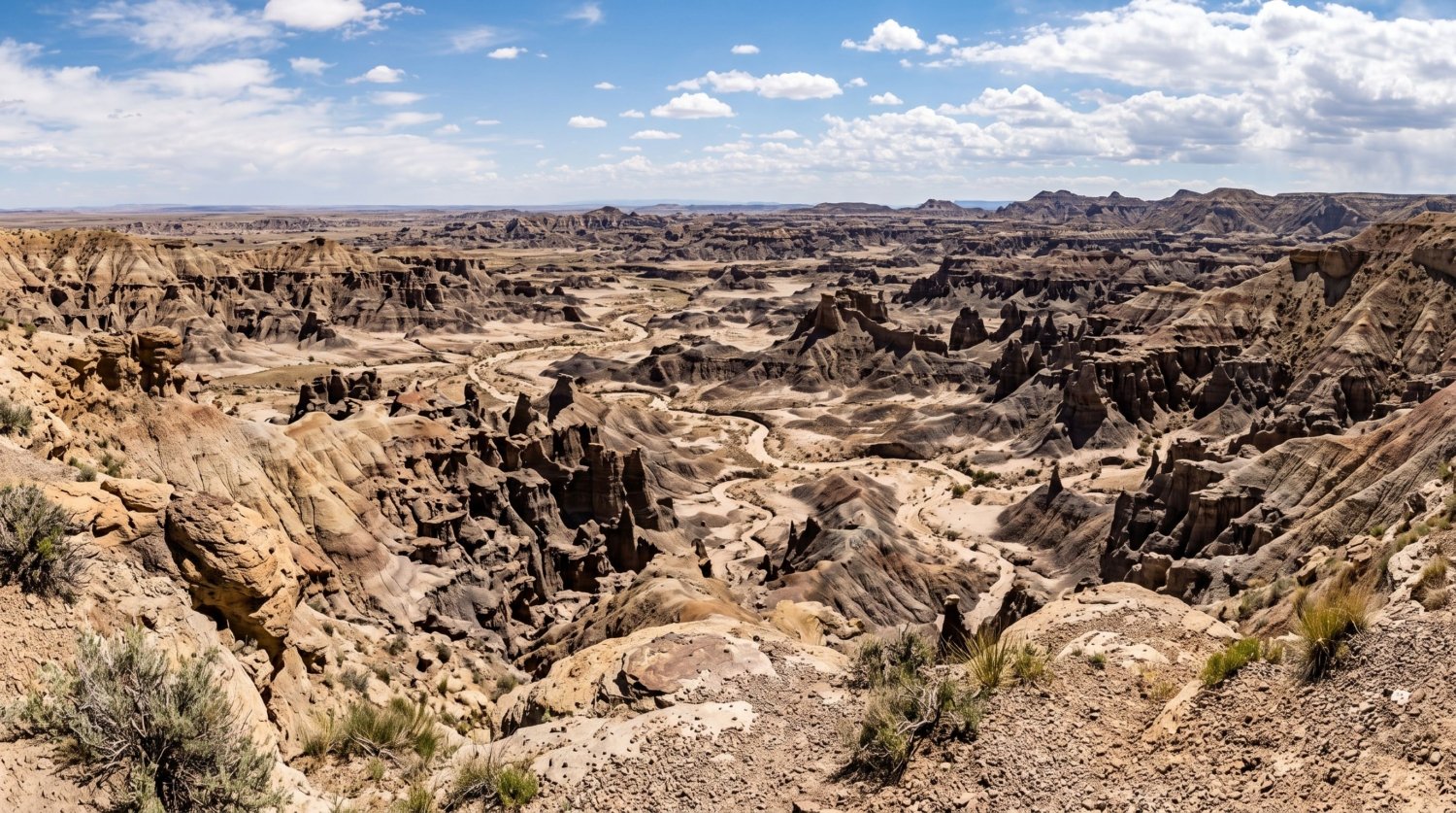
The terrain compounds it. Visitors who’ve spent real time here describe a landscape with a lot of dead ends and canyon mazes, where the most photographed formations sit two to five miles round trip from either trailhead and finding them without GPS coordinates or a strong sense of direction is genuinely difficult. That’s a real barrier in a way a paved overlook never is, and it’s the honest reason this hasn’t become the next Antelope Canyon despite decades of photographs online: the photographs travel easily, but the place itself resists a quick visit.
What You’ll Actually See
There’s no single “main attraction” the way a national park has a signature overlook — part of the appeal is that the landscape keeps revealing new formations the farther you wander off-trail. A cluster nicknamed the Cracked Eggs sits among a nursery-like field of rounded, fractured hoodoo caps that genuinely do resemble broken shells. Nearby, thin stone spires locals call the Wings on the Flats rise out of open ground with almost no surrounding cover, dramatic in low light precisely because there’s nothing else around them for scale. Elsewhere, a small natural rock window and scattered petrified logs turn up in washes that look identical to the one before it — which is exactly the disorientation the BLM warns about.
Collecting is where the honesty matters most: petrified wood collection is prohibited under the wilderness’s management plan, and any vertebrate fossil — a bone fragment, a tooth — requires an actual research permit to remove. The instinct to pocket a piece of “pretty rock” is understandable and also exactly what would slowly erase the fossil record that makes this place scientifically significant in the first place. Photograph it, leave it.
Getting There and Planning Your Visit
Two unmarked trailheads give access to the wilderness. The Bisti Trailhead sits about 36 miles south of Farmington off NM-371, with a small dirt parking area, a vault toilet, a shaded picnic spot, and an information kiosk — the closest thing to infrastructure the wilderness has. The De-Na-Zin Trailhead, about 12 miles south of Bloomfield off US-550, has a dirt parking area but no restroom facilities at all. A high-clearance vehicle is recommended for both approaches, and the access roads should be avoided entirely after rain or snow, when the clay becomes slick and can strand a vehicle.
- Water: none available anywhere in the wilderness — bring everything you’ll need, plus a margin.
- Navigation: no marked trails; download GPS coordinates for specific formations in advance or bring a dedicated GPS unit, since phone service is unreliable.
- Camping: primitive, dispersed camping is allowed with no permit, up to a 14-day stay limit.
- Timing: early morning and late afternoon give the best light for the hoodoos and the most tolerable temperatures; spring and fall avoid both summer heat and winter mud.
- Cost: free, with no entrance fee or reservation system of any kind.
This isn’t a place to improvise a first outdoor trip. It rewards hikers who are comfortable navigating without a trail, carrying their own water and safety margin, and turning back if the light or the weather turns before they’ve found what they came for.
Who This Isn’t For
It’s worth saying plainly: this is not a family afternoon stop or a place to visit on a whim between other plans. There’s no cell rescue if someone gets hurt or lost, no shade beyond what a rock formation happens to provide, and no one checking whether you made it back to the trailhead. Compare that to a place like Antelope Canyon, which solved its own overcrowding by adding guided tours and timed permits — infrastructure that makes a fragile site accessible to almost anyone, at the cost of the solitude that made it special. Bisti has taken the opposite path by default: it has stayed wild and empty specifically because it never built that infrastructure, which means the burden of preparation sits entirely on the visitor instead of a permit system. That trade-off is exactly what keeps it worth visiting for the right kind of traveler, and exactly why it’s the wrong choice for anyone looking for an easy, low-effort stop.
Frequently Asked Questions
Do I need a permit to visit Bisti/De-Na-Zin?
No. There’s no entrance fee, reservation, or permit required to hike or camp in the wilderness, though a research permit is required to remove any vertebrate fossil.
Can I visit without a high-clearance vehicle?
It’s possible in dry conditions with a standard car driven carefully, but the BLM recommends high clearance, and the unpaved access roads can become impassable after rain or snow regardless of vehicle type.
Is it safe to hike alone?
Solo hikers do visit regularly, but the lack of cell service, marked trails, and water means any injury or navigation mistake has to be handled entirely on your own. A GPS device, a full water supply, and telling someone your planned route and return time are the minimum precautions worth taking.
What’s the best time of year to go?
Spring and fall offer the most comfortable temperatures and the lowest chance of the access roads turning to mud. Summer heat on the exposed clay can be intense with zero shade, and winter brings the added risk of snow or rain making the roads impassable.
Between a fossil record that runs straight through the extinction of the dinosaurs, hoodoos with no fence or placard in sight, and a landscape that has resisted every incentive to become the next viral overlook, the Bisti/De-Na-Zin Wilderness makes the case that “hidden” can still mean something in an oversaturated Southwest. If you’re planning a wider trip through underrated natural landscapes, our guides to hidden natural wonders near San Diego and underrated hiking trails in Colorado’s Front Range cover the same instinct — real terrain over easy photo ops — in two more corners of the American West.