
The Matterhorn gets photographed from the same three spots in Zermatt so often that MySwitzerland itself markets the country’s other landscapes as separate attractions, not footnotes to the Alps. Switzerland’s geology did most of the interesting work underground and inside rock, not on a mountain’s summit ridge: a limestone slot the width of a hallway, a rock amphitheater carved by an ice-age glacier, a thermal spring that spends a decade traveling underground before it resurfaces. None of these three needed a peak to be dramatic.
Last verified: August 30, 2026. Entry fees, opening dates, and transit schedules below change by season — the linked pages update faster than this article does, so check them directly before you plan around a specific date.
Creux du Van: An Amphitheater the Ice Age Left Behind
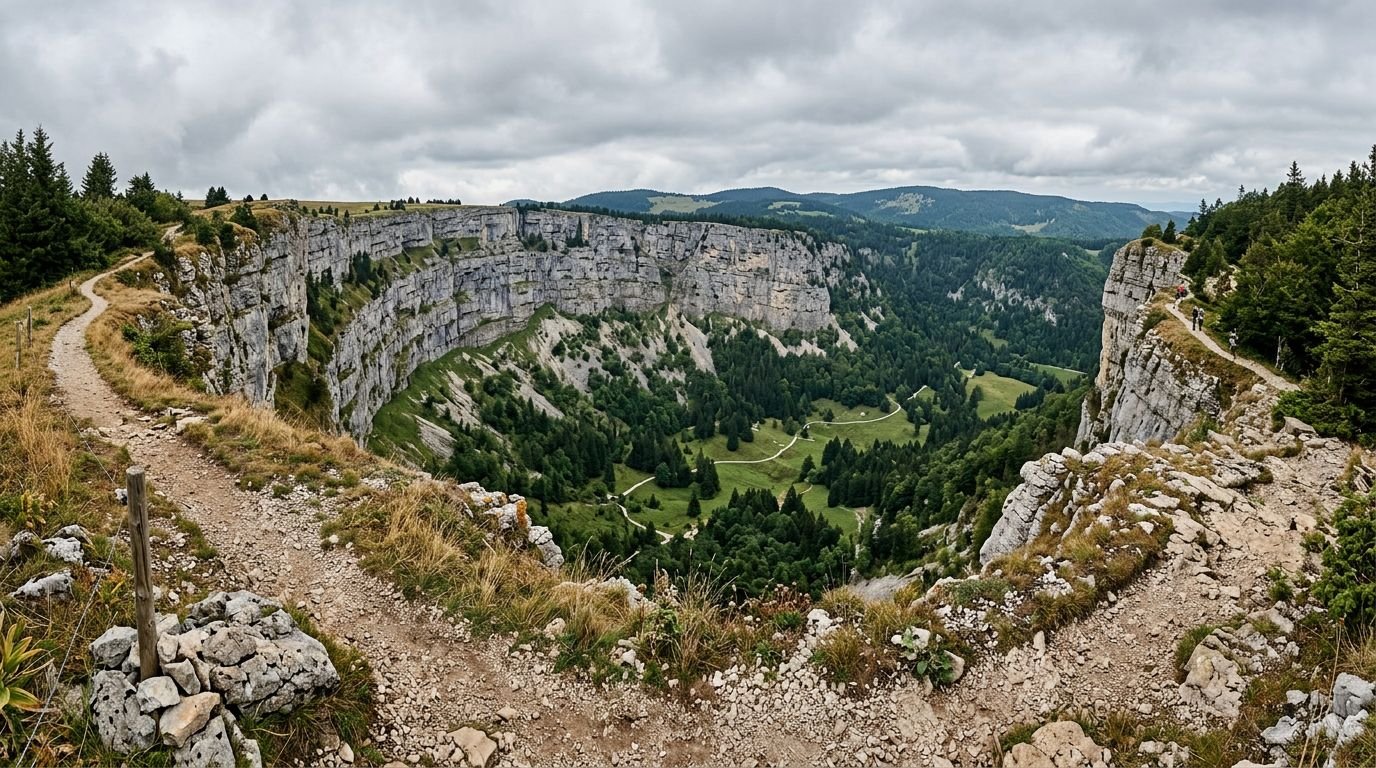
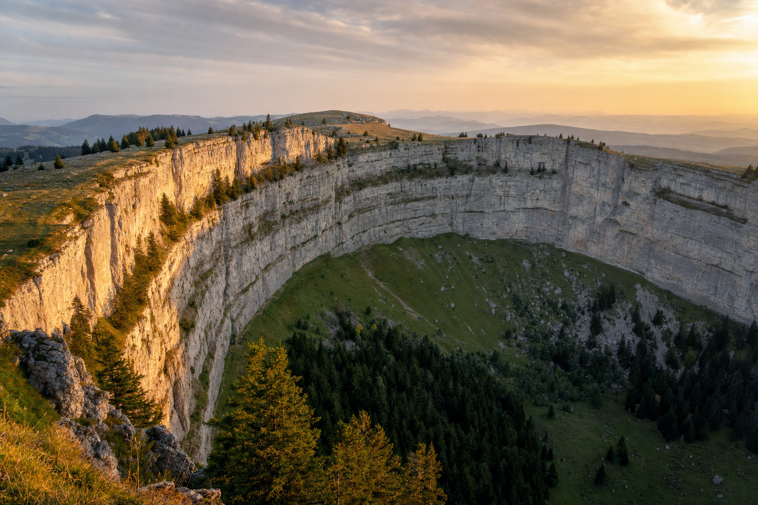
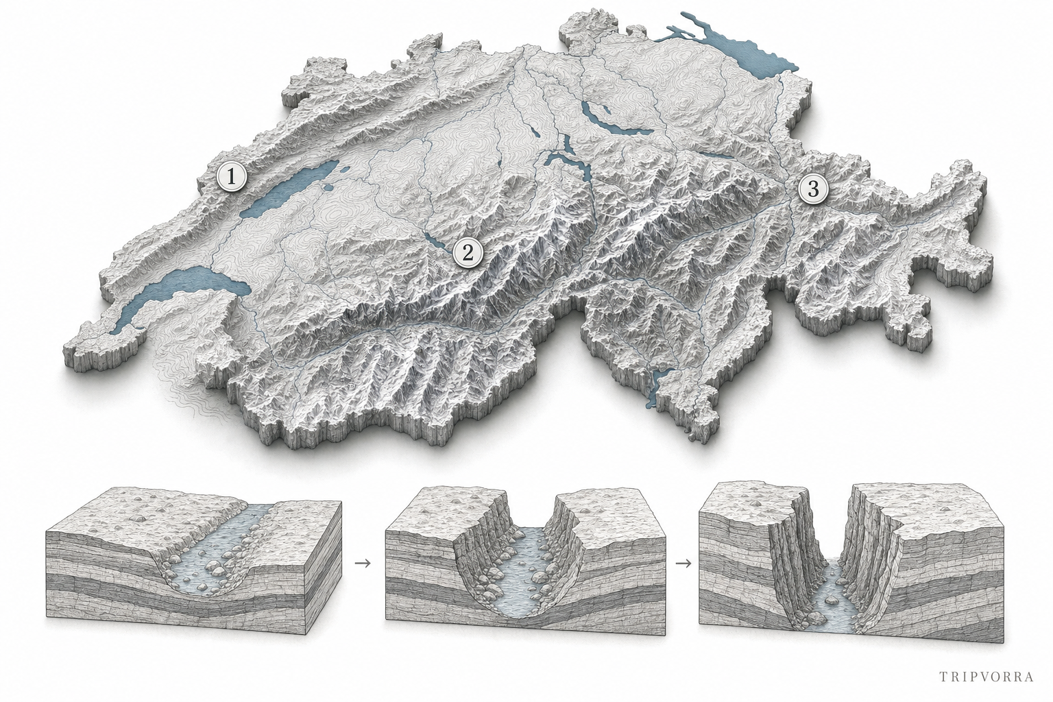
During the Würm glaciation, around 140,000 years ago, a glacier filled the valley here and meltwater began cutting into the Jura mountains’ limestone. As the ice retreated through repeated warm-cold cycles, freeze-thaw fracturing stripped away weaker, fault-cracked rock while the more resistant limestone bands held their ground — the result, over tens of thousands of years, is a near-perfect semicircular cliff face rather than the V-shaped valley the process usually leaves behind. Switzerland’s own tourism board calls it, without much modesty, “Switzerland’s Grand Canyon” — a claim that undersells how little international attention it actually gets compared to the label.
The straightforward route starts at Noiraigue station, on the direct line from Neuchâtel, and the full circular hike to the rim and back runs about 14 km with 600 meters of elevation gain — a genuine half-day commitment on exposed, sometimes loose terrain, not a stroll. A shorter route exists for anyone who wants the view without the full loop: a paved road reaches Ferme du Soliat, a working farm restaurant close to the rim, cutting the walking down to 30–40 minutes each way. There’s no entrance fee — it’s an open nature reserve, not a ticketed attraction — but there’s also no shelter or facilities partway up, and the exposed cirque paths are genuinely unsafe once ice sets in, which is why the reserve is a spring-through-autumn destination rather than a year-round one.
Aare Gorge: The River That Kept Choosing New Ground
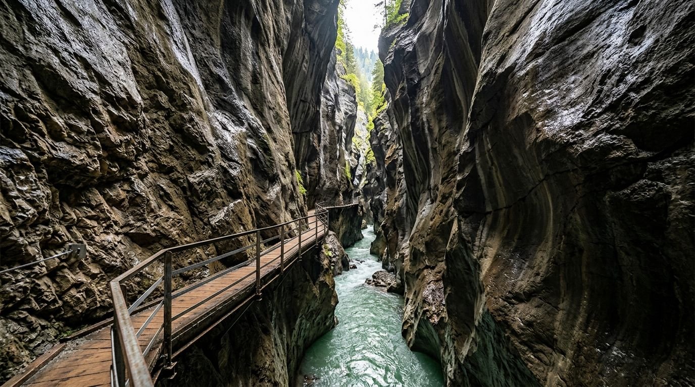
The Aare cut this gorge through Cretaceous-period marine limestone, rock old and hard enough that it resisted the folding that built the Alps around it — which is precisely why the river stayed trapped in a narrow slot instead of carving a wider valley the way softer rock would allow. What makes the geology genuinely unusual is documented on the gorge’s own geology page: across repeated glacial and interglacial cycles, the river didn’t keep reopening the same channel. Warm periods let meltwater cut a new path through the limestone; the next glacial advance backfilled it with moraine debris; the following thaw cut a fresh channel elsewhere rather than clearing the old one. Geologists have traced five earlier, now-buried gorges running roughly parallel to the current one — the gorge you walk through today is only the most recent of at least six attempts.
The walkway runs 1.4 km through walls up to 200 meters high, narrowing to about a meter across at the tightest section, and takes 45 to 60 minutes end to end. Two stations — Aareschlucht West and Aareschlucht Ost, both a short walk from Meiringen — bookend the route, so a one-way walk with a return by bus or train is straightforward. Entry runs around 12 Swiss francs for an adult (confirm the current rate before visiting), and the west-side approach to the middle of the gorge is stroller- and wheelchair-accessible, which isn’t something you can say about most Alpine landscapes. Its own operators describe it plainly as one of the most popular destinations in the Bernese Oberland — worth saying honestly, since this isn’t a secret to anyone who’s spent time in the region. It’s just rarely on an international visitor’s Switzerland itinerary, which sticks to Interlaken’s postcard lake views a few kilometers away. The gorge closes for winter and reopens in spring; check the current-year date before building a trip around it.
Tamina Gorge: A Spring That Takes a Decade to Reach Daylight
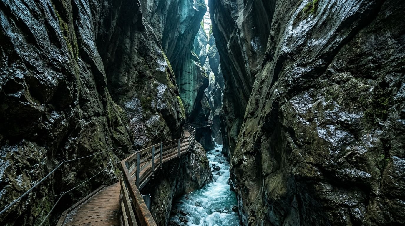
This is the least-known of the three, and the story behind it is stranger than the rock formation itself. Around 1240, hunters from nearby Pfäfers Abbey followed a wounded animal into this gorge and found a thermal spring bubbling out of the rock at a constant 36.5°C. According to Taminatherme’s own account of the spring’s hydrology, that water first fell as rain or snow roughly a thousand meters higher, then spent close to ten years working its way down through fractured rock before reaching the gorge floor — which means the water resurfacing today fell before most smartphones existed. Benedictine monks built the first bathhouse directly inside the gorge around 1350; by 1704 they’d replaced it with a structure grand enough to later employ Paracelsus, the physician and alchemist, as resident doctor. That building, Alte Bad Pfäfers, is Switzerland’s oldest surviving Baroque bathhouse and now operates as a small museum rather than a working spa — the water itself was rerouted downhill to the modern Tamina Therme resort in Bad Ragaz decades ago.
The gorge itself is a slot roughly 600 meters long and up to 100 meters deep, with walls barely 10 meters apart in places and visibly tilted — not vertical, but leaning at close to 15 degrees, a detail that’s easy to miss in photos and striking in person. It’s a flat, cable-secured walking path rather than a climb, which makes it accessible to almost anyone reasonably fit, and it’s reached from Bad Ragaz by an hourly PostBus or a roughly 90-minute walk from town, with the trail itself closed to cars, bikes, and e-scooters — you’re walking or nothing. Entry is a flat 5 Swiss francs, and the gorge operates on a fixed seasonal calendar (roughly May through late October) because the regional roads authority periodically closes it for rockfall assessment — a real constraint, not a formality, so it’s worth confirming the gorge is open before making the trip out.
Why These Three and Not the Obvious Alternatives
Lake Oeschinen and Trümmelbach Falls came up constantly in researching this list, and both are genuinely worth seeing — but neither belongs on a list about staying off the well-worn path. Oeschinen’s operator introduced a mandatory reservation system for its gondola in 2025 specifically to manage crowd volume at what’s openly described as an Instagram hotspot, and Trümmelbach’s own visitors report tour-bus queues at the internal lift long enough that guides recommend arriving before the buses do. Calling either one “hidden” would be marketing, not reporting. The Verzasca river’s turquoise water is real and its bedrock is genuinely distinctive pale gneiss, but the valley’s global fame dates to 1995, when the opening bungee-jump scene of GoldenEye was filmed at the Verzasca Dam — it’s a Bond-movie landmark now, not an undiscovered one.
Two of the three picks above aren’t strangers to Swiss and nearby European travelers either, and this list doesn’t pretend otherwise: Creux du Van has an official nickname and Aare Gorge is openly marketed as a Bernese Oberland highlight. What they share, and what Oeschinen and Trümmelbach don’t, is that neither shows up on the international “best of Switzerland” circuit that funnels visitors toward the Jungfrau region’s cable cars and Zermatt’s Matterhorn views. Tamina Gorge is the one genuine outlier — a few hundred reviews online, promoted almost entirely by regional tourism bodies rather than global campaigns, and worth the extra transit time precisely because so few visitors bother.
Planning a Trip Around All Three
These three sit in different corners of the country and don’t form a single route — Creux du Van is near Neuchâtel in the Jura, Aare Gorge is in the Bernese Oberland near Meiringen, and Tamina Gorge is near Bad Ragaz close to the Graubünden border. Switzerland’s rail network makes any one of them a reasonable day trip from Zurich, Bern, or Geneva, but combining two in one trip means planning around SBB’s timetables rather than driving distance alone. If you’re building a broader itinerary around underrated landscapes rather than checklist landmarks, the same research approach applies to our towns beyond the obvious circuit in Spain and our towns beyond Dublin in Ireland — real sourcing, no invented superlatives, honest tradeoffs stated plainly.