
Santorini and Mykonos post a combined 4.5 million international air arrivals a year. Most of the other 5,999 Greek islands post nowhere near that, and a handful of them post nothing at all — because they don’t have an airport to count arrivals through in the first place. That absence of infrastructure is not an accident of neglect. On islands like Folegandros, it’s the reason the place still looks the way it does.
This is a guide to five islands that sit outside the Santorini/Mykonos gravity well for genuinely different reasons — geology on one, a marble-carving economy on another, a bridge to the mainland on a third. None of them are secrets. Sifnos has a devoted following among Greek food writers; Karpathos has a fiercely protective relationship with its own traditions; Lefkada fills up with domestic road-trippers every July. What they share is that almost none of that attention comes from the international package-tour circuit that built Santorini’s caldera-view hotels and Mykonos’s beach-club economy.
Last verified: August 30, 2026. Ferry schedules, airline routes, and prices in this guide change seasonally — the sources at the end link directly to the operators and authorities you should check before booking.
Where These Five Sit
Milos and Folegandros are volcanic and near-waterless Cycladic islands an hour or two apart by boat. Sifnos sits between them, older in its tourism history but still overwhelmingly domestic in its visitor base. Karpathos is a long way east, in the Dodecanese, closer culturally to Crete than to the Cyclades. Lefkada is the outlier: it isn’t reached by boat at all for most visitors, because a floating bridge connects it to the Greek mainland.
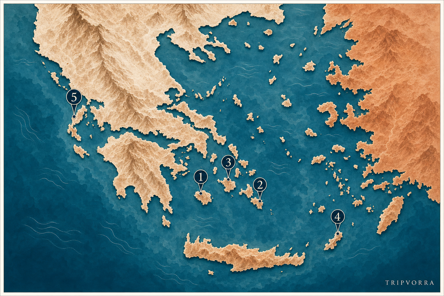
Map key: 1. Milos (Cyclades) — 2. Folegandros (Cyclades) — 3. Sifnos (Cyclades) — 4. Karpathos (Dodecanese) — 5. Lefkada (Ionian).
Milos: A Volcanic Coastline, Not a Postcard Beach
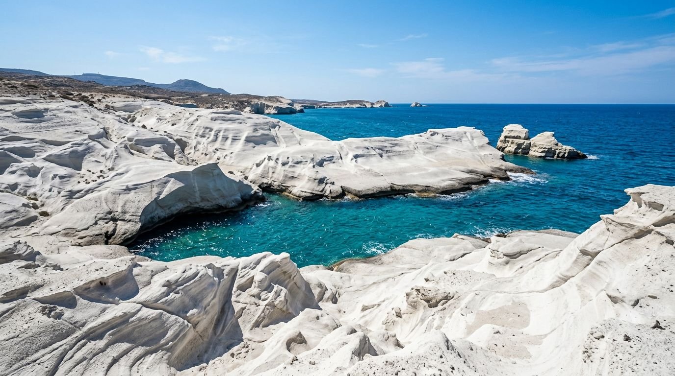
Milos is not a beach island in the usual sense. It’s a volcanic one, and the difference shows up the moment you reach Sarakiniko on the north coast: a stretch of bone-white pumice and tuff, wind-carved into folds and hollows, with no sand at all. It looks lunar because it is, geologically speaking, a very unusual rock rather than a scenic backdrop. The same volcanic chemistry gave the island a workable obsidian source in the Bronze Age, traded across the Aegean long before anyone called it a tourist destination.
The Venus de Milo was pulled out of a field near ancient Melos in 1820 and now lives in the Louvre, but the site where she was found, and the early Christian catacombs cut into the rock near Trypiti — among the largest in Greece — are still there and still open. Neither gets the crowds a discovery of that scale might draw on a more visited island.
The numbers explain some of that gap. Milos’s small island airport handled around 118,000 passengers in 2024, against Santorini’s 2.9 million and Mykonos’s 1.6 million (Hellenic Civil Aviation Authority data, reported via GTP Headlines). It’s a genuine air-arrivals difference of well over an order of magnitude, not a rounding error, and it tracks with what the island feels like outside of August: a working port town, Adamas, with tourism as one industry among several rather than the only one.
Milos’s airport takes only small turboprop aircraft and has seasonal domestic connections to Athens — check current carriers directly, since operators on this route change from year to year. By sea, Blue Star Ferries, Seajets, and several other lines run Piraeus–Adamas year-round; the fast boats do it in about two and a half hours, the conventional ones closer to seven, with deck fares from roughly €33 one-way. A rental car is worth having for the ring road and the trailheads, though buses reach the main beaches and villages.
May, June, and September are the calmer months here; August brings real crowding on the single coastal road near Sarakiniko and Kleftiko, and the island’s health center — not a hospital — means anything serious gets evacuated to Athens by boat or helicopter. That’s a fact worth knowing before you go, not a reason to avoid it.
Folegandros: An Island With No Airport, on Purpose or Not
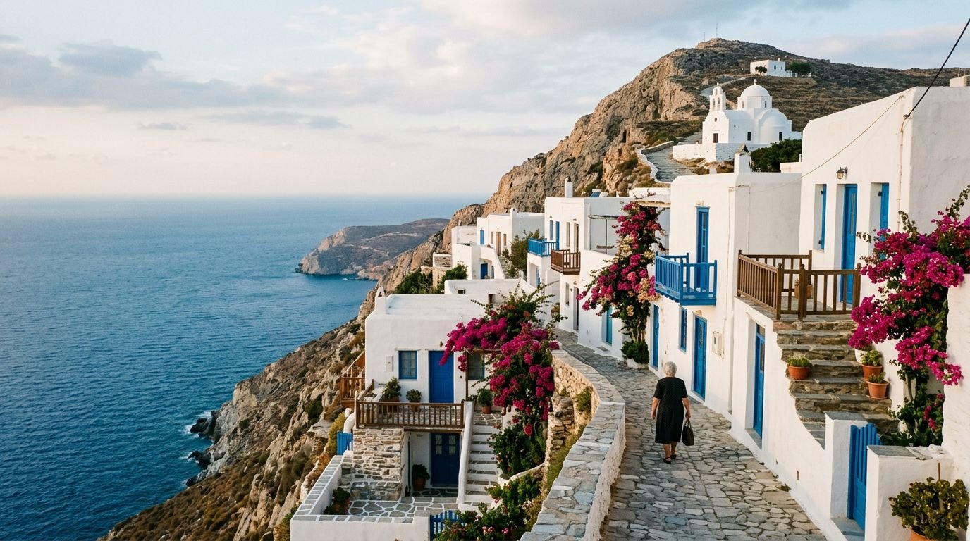
Folegandros has no airport, and that single infrastructure fact does most of the work of keeping it small. There’s no fly-in package tourism possible here at all — every visitor arrives by ferry, which is a real filter on volume even before anyone thinks about marketing an island as “unspoiled.” A Global Water Partnership field study puts the island’s permanent population at around 800, absorbing more than 40,000 visitors across a typical summer. That’s a sharp seasonal ratio, but the absolute numbers stay well below what a single Mykonos summer week can bring through its airport.
Chora, the main town, sits on a cliff roughly 200 meters above the sea and is built directly onto the walls of a Venetian-era fortified Kastro — the outer house walls form what was once the settlement’s defensive perimeter, a specific structural detail rather than a generic whitewashed-village description. A switchback path climbs from town to the Church of Panagia above it, a route most visitors walk at sunset.
The island’s water scarcity is real and documented, not a rhetorical flourish: it’s serious enough that Folegandros became a test site for hydropanel technology that condenses drinking water from air, backed by EU and Global Water Partnership funding. If you visit, conserve water as a matter of course rather than habit — it isn’t an abstraction here.
Piraeus–Folegandros ferries run 4 to 7 times a week depending on season, from about 3 hours 40 minutes on the Seajets high-speed boat to 7–8.5 hours on conventional lines, with fares starting around €39. There’s no airport alternative — the nearest are Santorini or Milos, with a further ferry leg from either. A car isn’t necessary; Chora and the nearby villages are walkable, and plenty of visitors go without one deliberately. Accommodation is genuinely limited in absolute bed count, so an August stay is worth booking two to three months out if you have a specific place in mind.
Sifnos: The Island Greek Food Writers Already Know
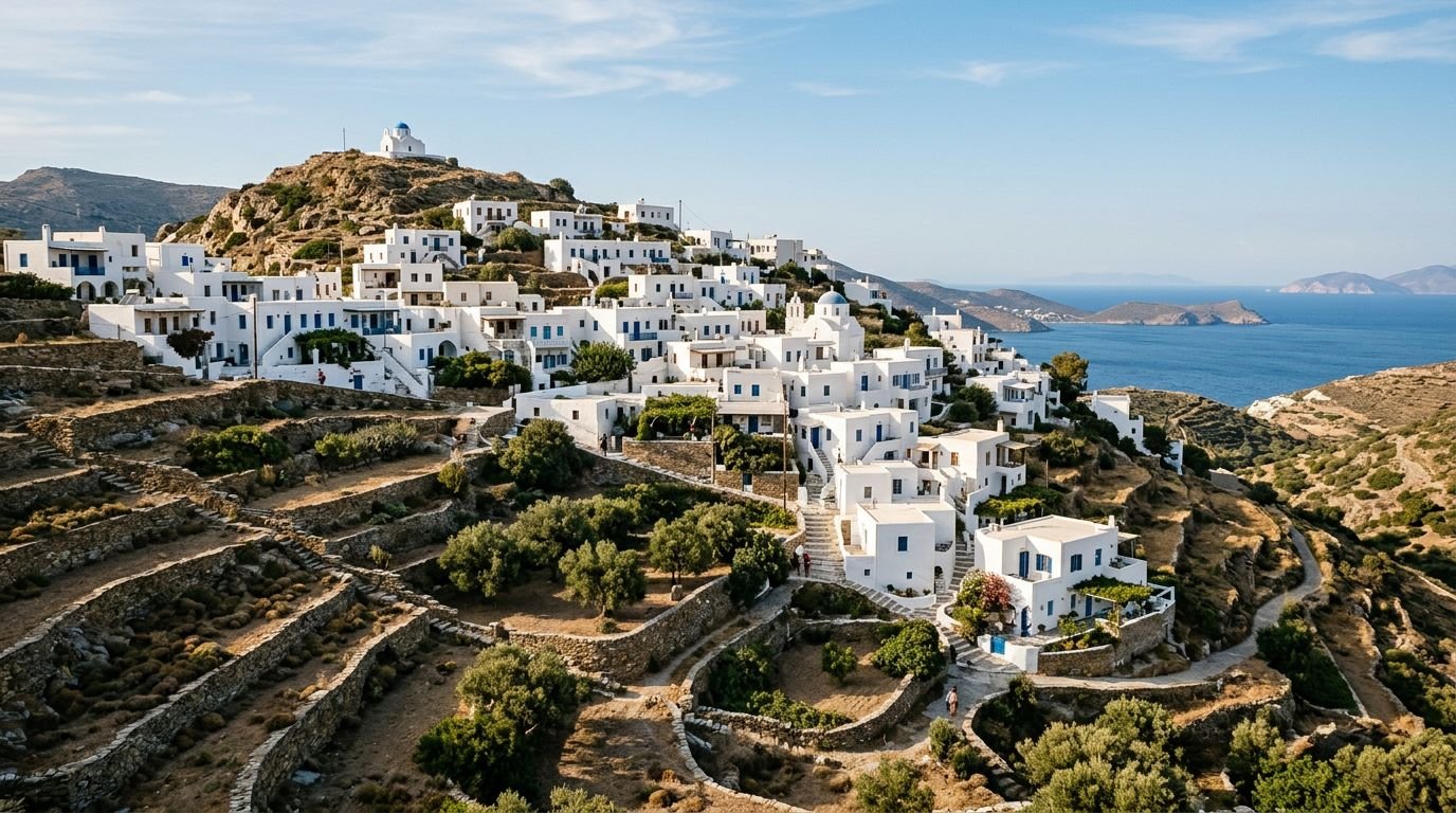
Sifnos isn’t unknown — it’s just unknown to a specific audience. Within Greece, it has a strong reputation among cooks and food writers, largely because of revithada, a chickpea dish traditionally slow-baked overnight in a clay pot in a wood-fired oven, and because the island has a centuries-old pottery tradition that still supplies working kitchens rather than just souvenir shelves. What it hasn’t built is the international profile of Santorini or Mykonos: reporting on Cycladic visitor volumes puts Sifnos at roughly 127,000 visitors across a May–October season, against weekly arrivals in the hundreds of thousands on Mykonos at peak.
The hilltop Kastro settlement, a former medieval capital, is built in a defensive cluster of interconnected houses with almost no gaps between them — a fortification strategy rather than an aesthetic one, similar in logic to Folegandros’s Kastro but architecturally distinct in its execution. Inland villages like Artemonas and Kastro itself sit on ridgelines with long views across terraced hillsides still used for agriculture.
Ferries reach Sifnos from Piraeus in about 2.5–4.5 hours depending on the boat, with several sailings a day in high season and fewer off-peak; there’s no airport. A car is useful for reaching villages spread across the island’s interior, though the bus network covers the main routes. The island has had a public, well-documented debate over construction pressure and water/sewage capacity as visitor numbers have grown — worth knowing as the kind of growing pain a “still finding its footing” tourism economy produces, rather than a reason to skip it.
Late spring and early autumn are the better windows for exploring the hillside paths between villages without midsummer heat; August is busy with both foreign and, notably, a large share of Greek domestic visitors, which changes the atmosphere from the international-crowd feel of Santorini.
Karpathos: Two Islands’ Worth of Culture in One Place
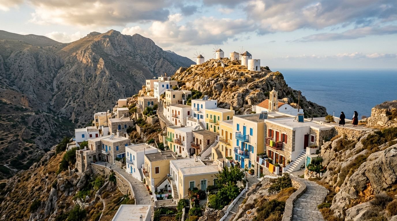
Karpathos sits in the Dodecanese, roughly equidistant from Rhodes and Crete, and its isolation shaped something more specific than just “fewer tourists.” The mountain village of Olympos, in the island’s remote north, kept a distinct dialect, embroidery and weaving traditions, and, among some older residents, traditional dress worn as daily clothing rather than performed for visitors — a level of cultural continuity that the EU’s own regional development documentation has cited when discussing the historical isolation and limited healthcare access of Greece’s remoter island communities.
That isolation is structural, not incidental: Karpathos has an airport, but it’s served by a limited number of routes compared with the dozens of international carriers flying into Santorini or Mykonos each summer, and getting to Olympos itself from the main town, Pigadia, still means a mountain drive of an hour or more. The south of the island, around the main town and Ammopi, is more developed and considerably easier to reach than the north.
Ferries connect Karpathos to Rhodes and, less frequently, to Piraeus on longer Dodecanese routes; flights from Athens and Rhodes are the faster option if time is limited. A car is close to essential for reaching Olympos and the island’s more remote beaches — public transport thins out considerably north of Pigadia. May through early October covers the practical visiting window; winter ferry and flight frequency drops sharply, and this is not an island to visit expecting shoulder-season infrastructure the way you might on a more developed Cycladic island.
The honest caveat here is about pace, not risk: Karpathos rewards a slower visit built around two distinct halves of the island — south for beaches and infrastructure, north for Olympos and its culture — and rushing between them in a day trip from a cruise stop misses most of what makes the island distinct.
Lefkada: The Greek Island You Can Drive To
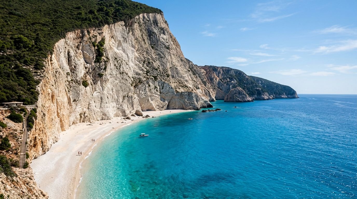
Lefkada breaks the pattern of every other island in this guide in one specific way: you can drive there. A floating pontoon bridge across the Agia Mavra strait connects it to the Greek mainland, carrying continuous road traffic and opening on a schedule to let boats through. From Athens it’s about a five-hour, 378-kilometer drive via the Rio–Antirrio bridge and the Aktio–Preveza undersea tunnel — no ferry required at all, which is a fundamentally different logistics profile from a fly-or-sail Cycladic island and one reason it doesn’t fit the usual “Greek island getaway” marketing template.
That accessibility has made it a strong domestic road-trip destination rather than an international fly-in one. Aktion National Airport, just across the strait on the mainland, does bring in seasonal European carriers, largely serving UK and European package travelers heading to the west-coast resorts — a different visitor profile again from either the Cyclades islands above or the mainland-drive crowd.
The island’s limestone cliffs at Porto Katsiki and Egremni are a different geological story from anything in the Cyclades — white limestone rather than volcanic tuff or granite — and Vasiliki Bay has an established reputation among European windsurfers for its reliable thermal winds, a specific, verifiable draw rather than a generic “watersports” mention. Lefkada also grows Vertzami, an indigenous red grape used in local wines distinct from the Assyrtiko whites associated with Santorini.
A car is genuinely necessary here — the cliff beaches and inland villages are spread out, and there’s no ferry-town center to base a car-free stay around the way Folegandros or Sifnos allow. May, June, and September avoid the heaviest domestic and European holiday traffic; the island sits in an active seismic zone (a magnitude 6.5 earthquake in 2015 caused fatalities and damaged the Egremni cliff face and Vasiliki’s harbor), a fact worth knowing rather than dwelling on.
A Word on Tinos
Tinos came up repeatedly in researching this guide, and it’s worth explaining why it isn’t one of the five. It has no airport and a genuinely distinct identity — Greece’s marble-carving center, with villages like Pyrgos still producing sculptors, and Volax, a village set in a field of giant granite boulders unlike anything else in the Cyclades. But it’s also one of Greece’s largest domestic pilgrimage sites, built around the Church of Panagia Evangelistria, and draws enormous Greek crowds around August 15 each year. That’s a different kind of popularity than Santorini’s, but it isn’t an absence of attention — Tinos is a headline destination for millions of Greek visitors, just not for the international market this list is written for. In June 2026, Greece’s Ministry of Environment and Energy declared a drinking-water emergency on Tinos alongside Alonissos, a detail that says more about a difficult season than about the island’s underlying popularity.
Getting Between Them
These five don’t form a single practical route, and that’s worth saying plainly rather than forcing a fake itinerary. Milos, Folegandros, and Sifnos are close enough for island-hopping within the Cyclades — a common pattern is Piraeus to one, a short ferry to the next, and a return leg from the third. Karpathos, in the Dodecanese, is a separate trip built around Rhodes rather than Athens. Lefkada, reachable by road, doesn’t connect to the other four by any practical ferry route and is better treated as its own mainland-adjacent trip, possibly combined with other Ionian islands like Kefalonia.
If you’re building a longer Greek itinerary around this guide, our towns beyond the obvious circuit in Spain and underrated towns in Italy pieces use the same approach — official sources, honest tradeoffs, no invented superlatives — if islands aren’t the only place you’re applying it.
Research & Sources
Air-arrival figures for Santorini, Mykonos, and Milos are drawn from Hellenic Civil Aviation Authority data reported via GTP Headlines (news.gtp.gr). Ferry routes, durations, and indicative fares are from live Ferryhopper route pages for Athens–Milos, Athens–Folegandros, and Athens–Tinos, checked August 2026 — confirm current schedules directly before booking, as operators and frequencies shift seasonally. Folegandros’s water situation is documented by the Global Water Partnership Mediterranean. General island profiles for Milos, Folegandros, and Karpathos are cross-checked against Visit Greece, the official Greek National Tourism Organisation site. The Symi day-tripper fee and Tinos water emergency, referenced for context, are reported by Greek Reporter. Lefkada’s road access and bridge schedule are documented by the Lefkada Slow Guide and Aktion National Airport’s own site. Some figures — including exact current-season airline carriers on Milos and Karpathos, and official hotel-capacity data for several islands — could not be independently verified from a primary source at time of writing and are flagged as such in the text rather than stated as fact.